Building date: 1841, razed 1887, replaced on same site with new larger brick church.
Original use: Church
Corner structures:
Mortar application and content:
Types and uses of stones:
Types and choice of windows:
Structures with similar masonry details:
Masons who worked on building:
Unique features:
Map views courtesy Google Maps. Address is Google Earth confirmed; 43°14'11.02"N 77°03'56.32"W.
Town of Sodus and Wayne County 1978 Highway Maps
Third M.E. Church, Sodus Village history sheet. From the personal research of cobblestone historian Karen Crandall.
Wayne Historians Organization (WHO), Historic Sites Inventory Third Methodist Episcopal Church (WHO), Historic Sites Inventory Website
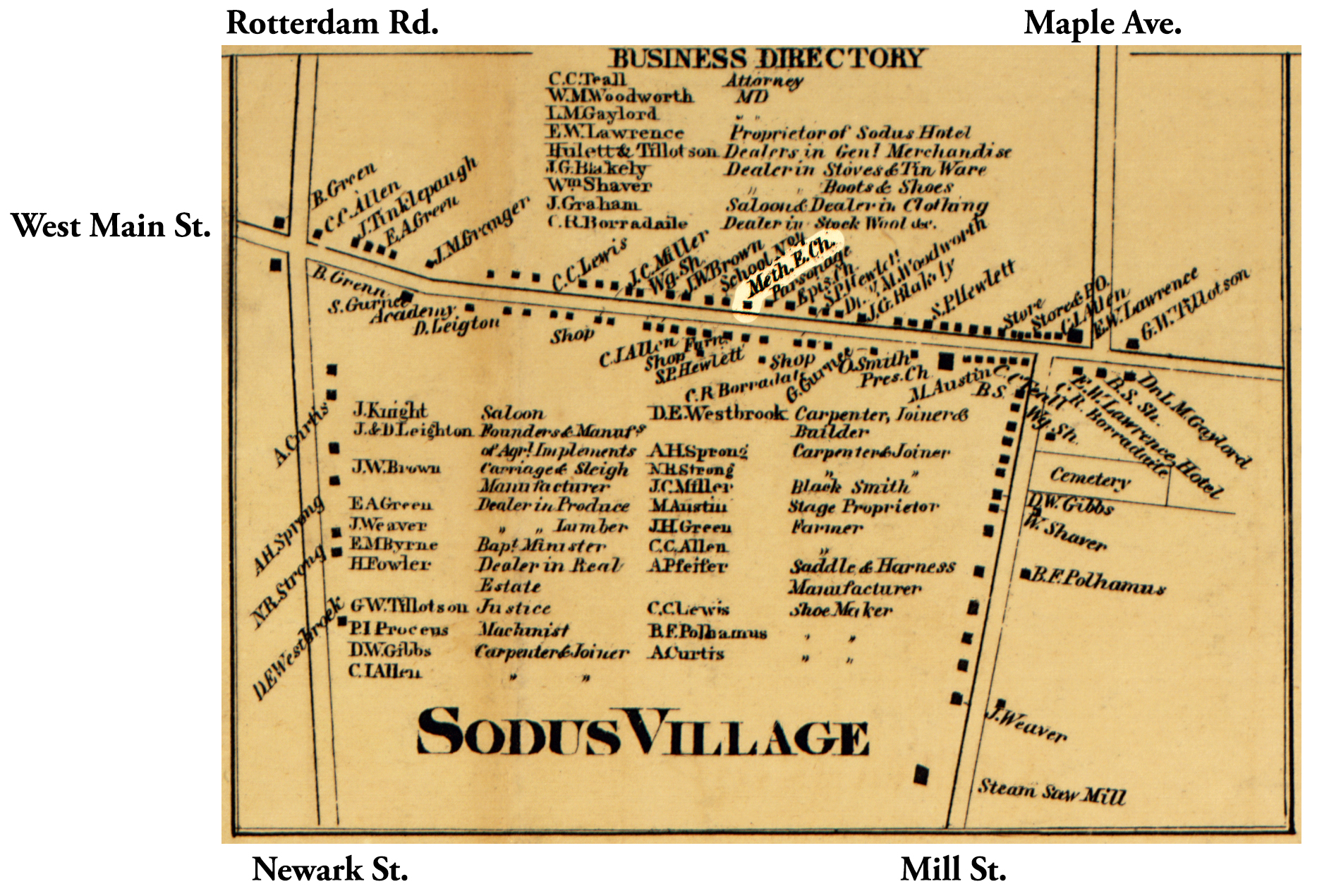 1858 Wayne County Sod-49 Excerpt Map.jpg ¹ |  WCMH Sod 3 Methodist cobblestone 1845-1887 Enhanced.jpg ² |
¹ 1858 Wayne County Sod-49 Map Excerpt courtesy Library of Congress.
² Image courtesy Wayne County Historical Society.
